


refuge Fontalnaba refuge les merveilles

taguette
User
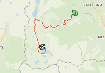

Length
11.9 km

Max alt
2570 m

Uphill gradient
788 m
Km-Effort
22 km

Min alt
2009 m

Downhill gradient
691 m
Boucle
No
Creation date :
2023-09-07 06:42:29.794
Updated on :
2023-09-08 17:45:08.615
5h54
Difficulty : Very difficult

FREE GPS app for hiking
 SityTrail
IGN / Geographical institutes
SityTrail Plus
The world is yours!
About
Trail Walking of 11.9 km to be discovered at Provence-Alpes-Côte d'Azur, Maritime Alps, Tende. This trail is proposed by taguette.
Positioning
Country:
France
Region :
Provence-Alpes-Côte d'Azur
Department/Province :
Maritime Alps
Municipality :
Tende
Location:
Unknown
Start:(Dec)
Start:(UTM)
378369 ; 4882573 (32T) N.
Comments