


chute du Diable

aldaus
User
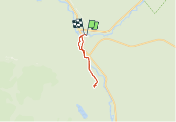

Length
7.8 km

Max alt
331 m

Uphill gradient
170 m
Km-Effort
10.1 km

Min alt
207 m

Downhill gradient
177 m
Boucle
Yes
Creation date :
2023-09-08 18:15:17.014
Updated on :
2023-09-08 20:46:49.514
2h18
Difficulty : Very easy

FREE GPS app for hiking
 SityTrail
IGN / Geographical institutes
SityTrail Plus
The world is yours!
About
Trail Walking of 7.8 km to be discovered at Quebec, La Haute-Gaspésie, Mont-Albert. This trail is proposed by aldaus.
Positioning
Country:
Canada
Region :
Quebec
Department/Province :
La Haute-Gaspésie
Municipality :
Mont-Albert
Location:
Unknown
Start:(Dec)
Start:(UTM)
710788 ; 5425518 (19U) N.
Comments