


nant

Henri.Vekemans
User

Length
2.4 km

Max alt
440 m

Uphill gradient
88 m
Km-Effort
3.3 km

Min alt
348 m

Downhill gradient
23 m
Boucle
No
Creation date :
2023-09-09 16:49:58.123
Updated on :
2023-09-09 17:30:27.125
40m
Difficulty : Easy

FREE GPS app for hiking
 SityTrail
IGN / Geographical institutes
SityTrail Plus
The world is yours!
About
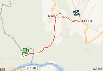
Trail Walking of 2.4 km to be discovered at Auvergne-Rhône-Alpes, Ain, Virignin. This trail is proposed by Henri.Vekemans.
Positioning
Country:
France
Region :
Auvergne-Rhône-Alpes
Department/Province :
Ain
Municipality :
Virignin
Location:
Unknown
Start:(Dec)
Start:(UTM)
712358 ; 5065622 (31T) N.
Comments