


balade du 11.09.2023

chrisgps
User
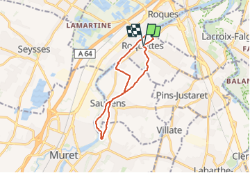

Length
12 km

Max alt
203 m

Uphill gradient
124 m
Km-Effort
13.6 km

Min alt
151 m

Downhill gradient
123 m
Boucle
Yes
Creation date :
2023-09-11 07:17:50.262
Updated on :
2023-09-11 14:41:52.821
3h06
Difficulty : Easy

FREE GPS app for hiking
 SityTrail
IGN / Geographical institutes
SityTrail Plus
The world is yours!
About
Trail Walking of 12 km to be discovered at Occitania, Haute-Garonne, Roquettes. This trail is proposed by chrisgps.
Positioning
Country:
France
Region :
Occitania
Department/Province :
Haute-Garonne
Municipality :
Roquettes
Location:
Unknown
Start:(Dec)
Start:(UTM)
367911 ; 4817558 (31T) N.
Comments