


Saint-Michel-en-Grève - GR34 Beg ar Forn Église - 7.7km 200m 2h15 (50mn) - 2023 09 13

Orcal37
User GUIDE
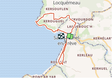

Length
7.7 km

Max alt
82 m

Uphill gradient
202 m
Km-Effort
10.4 km

Min alt
0 m

Downhill gradient
199 m
Boucle
Yes
Creation date :
2023-09-13 08:58:12.032
Updated on :
2023-09-23 14:13:15.425
2h15
Difficulty : Medium

FREE GPS app for hiking
 SityTrail
IGN / Geographical institutes
SityTrail Plus
The world is yours!
About
Trail Walking of 7.7 km to be discovered at Brittany, Côtes-d'Armor, Saint-Michel-en-Grève. This trail is proposed by Orcal37.
Description
Saint-Michel-en-Grève - GR34 - Beg ar Forn - Église - Pont ar Roscoat - 7.7km 200m 2h15 (50mn) - 2023 09 13
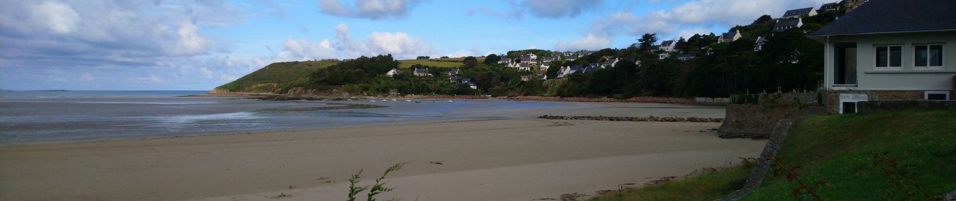
Photos
 - 2023 09 13 - Photo 1")
 - 2023 09 13 - Photo 2")
 - 2023 09 13 - Photo 3")
 - 2023 09 13 - Photo 4")
 - 2023 09 13 - Photo 5")
 - 2023 09 13 - Photo 6")
 - 2023 09 13 - Photo 7")
 - 2023 09 13 - Photo 8")
 - 2023 09 13 - Photo 9")
 - 2023 09 13 - Photo 10")
 - 2023 09 13 - Photo 11")
 - 2023 09 13 - Photo 12")
Positioning
Country:
France
Region :
Brittany
Department/Province :
Côtes-d'Armor
Municipality :
Saint-Michel-en-Grève
Location:
Unknown
Start:(Dec)
Start:(UTM)
458228 ; 5392381 (30U) N.
Comments