


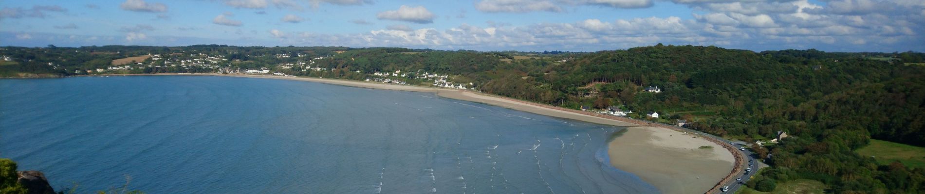
Saint-Michel-en-Grève - GR34 le Grand Rocher - 12km 300m 4h05 - 2023 09 13

Orcal37
User GUIDE
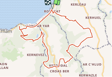

Length
12.1 km

Max alt
105 m

Uphill gradient
294 m
Km-Effort
16 km

Min alt
0 m

Downhill gradient
296 m
Boucle
Yes
Creation date :
2023-09-13 12:16:16.656
Updated on :
2023-09-23 14:16:43.485
4h05
Difficulty : Difficult

FREE GPS app for hiking
 SityTrail
IGN / Geographical institutes
SityTrail Plus
The world is yours!
About
Trail Walking of 12.1 km to be discovered at Brittany, Côtes-d'Armor, Saint-Michel-en-Grève. This trail is proposed by Orcal37.
Description
Saint-Michel-en-Grève - Pont ar Roscoat - GR34 - Chapelle Sainte-Geneviève - le Moulin Giglou - le Grand Rocher - 12km 300m 4h05 - 2023 09 13
Photos


Positioning
Country:
France
Region :
Brittany
Department/Province :
Côtes-d'Armor
Municipality :
Saint-Michel-en-Grève
Location:
Unknown
Start:(Dec)
Start:(UTM)
457957 ; 5391713 (30U) N.
Comments