


la Balme de Eiendre

cousam
User
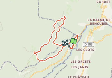

Length
10.2 km

Max alt
1117 m

Uphill gradient
573 m
Km-Effort
18 km

Min alt
586 m

Downhill gradient
624 m
Boucle
Yes
Creation date :
2023-09-14 06:58:21.53
Updated on :
2023-09-14 16:28:03.708
5h29
Difficulty : Difficult

FREE GPS app for hiking
 SityTrail
IGN / Geographical institutes
SityTrail Plus
The world is yours!
About
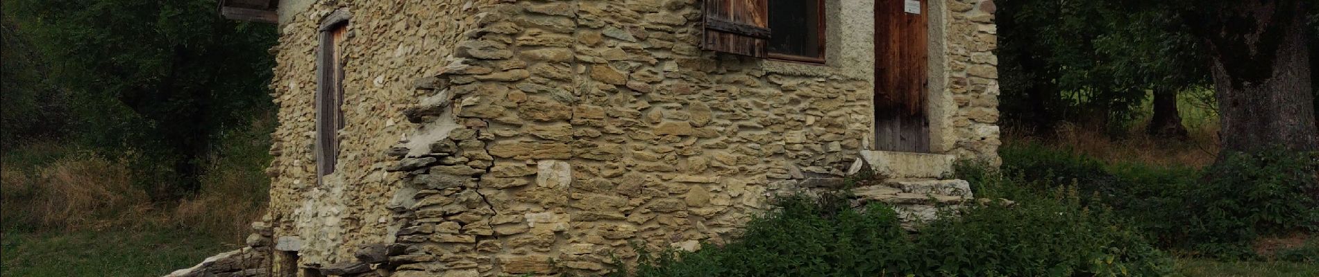
Trail Walking of 10.2 km to be discovered at Auvergne-Rhône-Alpes, Isère, Choranche. This trail is proposed by cousam.
Photos

Positioning
Country:
France
Region :
Auvergne-Rhône-Alpes
Department/Province :
Isère
Municipality :
Choranche
Location:
Unknown
Start:(Dec)
Start:(UTM)
692935 ; 4994488 (31T) N.
Comments