


Trélévern - GR34 Nantouar Plage du Royo - 13km 210m 3h20 - 2023 09 14

Orcal37
User GUIDE
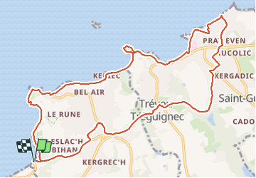

Length
13 km

Max alt
73 m

Uphill gradient
208 m
Km-Effort
15.8 km

Min alt
0 m

Downhill gradient
208 m
Boucle
Yes
Creation date :
2023-09-14 12:28:59.122
Updated on :
2023-09-23 14:28:29.587
3h20
Difficulty : Difficult

FREE GPS app for hiking
 SityTrail
IGN / Geographical institutes
SityTrail Plus
The world is yours!
About
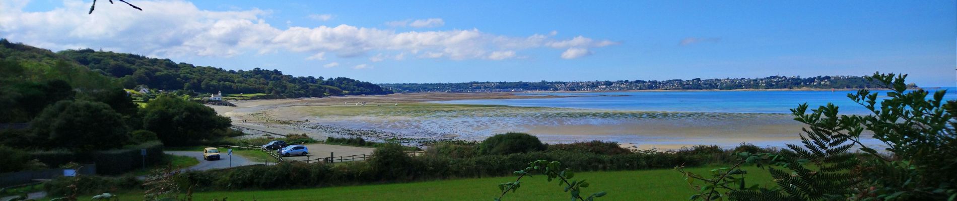
Trail Walking of 13 km to be discovered at Brittany, Côtes-d'Armor, Trélévern. This trail is proposed by Orcal37.
Description
Trélévern - GR34 - Nantouar - Port l'Epine - Port le Goff - Plage du Royo de Trévou-Tréguignec - Eglise - Trélévern - Eglise - 13km 210m 3h20 - 2023 09 14
Photos


Positioning
Country:
France
Region :
Brittany
Department/Province :
Côtes-d'Armor
Municipality :
Trélévern
Location:
Unknown
Start:(Dec)
Start:(UTM)
471503 ; 5405716 (30U) N.
Comments