Trail Walking Châtillon-en-Diois - Pellebit - Photo
 ajd26
ajd26

User

© OpenStreetMap contributors
Length
Length
14.2 km
Max alt
Max alt
1483 m
Uphill gradient
Uphill gradient
987 m
Km-Effort
Km-Effort  
27 km
Min alt
Min alt
638 m
Downhill gradient
Downhill gradient
990 m
Boucle
Boucle
Yes
Creation date :
2023-09-14 07:26:29.0
Updated on :
2023-09-15 09:40:08.583

(0 Reviews)

Walking
Walking
6h13
Difficulty : Very difficult

Scan this QR Code to open this trail in the SityTrail application

FREE GPS app for hiking

Logo SityTrail SityTrail

IGN / Geographical institutes

Download SityTrail from the App Store Download SityTrail from Google Play

Logo SityTrail SityTrail Plus

The world is yours!

Download SityTrail from the App Store Download SityTrail from Google Play Download SityTrail on Huawei AppGallery

About

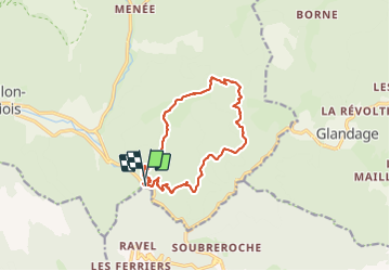
Trail Walking of 14.2 km to be discovered at Auvergne-Rhône-Alpes, Drôme, Châtillon-en-Diois. This trail is proposed by ajd26.

Description

Grotte et chemin des gardes
belle rando, on a pu traversé par la grotte, c'est un petit plus, quand on rentre dans la grotte, on ne voit pas l'autre bout mais ça passe
ensuite la descente de "la Serrie" sur le col de Porte est très très raide, pas dangereuse on est en sous bois
puis le chemin des gardes est super joli car on chemine en balcon au dessus d'un vallon
au hameau de l'église, prendre le temps de voir les reste de fresques dans l'église

Elevation profile

Photos

Positioning

Country:
France
Region :
Auvergne-Rhône-Alpes
Department/Province :
Drôme
Municipality :
Châtillon-en-Diois
Location:
Treschenu-Creyers
Start:(UTM)
700765 ; 4950055 (31T) N.


Close
My subscriptions