


banon col du negron col homme mort

BELLETGE
User
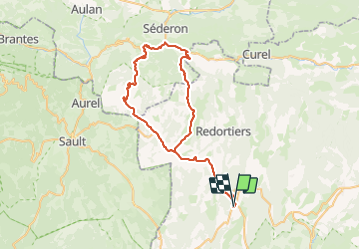

Length
69 km

Max alt
1245 m

Uphill gradient
1254 m
Km-Effort
86 km

Min alt
720 m

Downhill gradient
1253 m
Boucle
Yes
Creation date :
2023-09-15 06:36:32.119
Updated on :
2023-09-15 11:10:23.382
4h06
Difficulty : Medium

FREE GPS app for hiking
 SityTrail
IGN / Geographical institutes
SityTrail Plus
The world is yours!
About
Trail Road bike of 69 km to be discovered at Provence-Alpes-Côte d'Azur, Alpes-de-Haute-Provence, Banon. This trail is proposed by BELLETGE.
Positioning
Country:
France
Region :
Provence-Alpes-Côte d'Azur
Department/Province :
Alpes-de-Haute-Provence
Municipality :
Banon
Location:
Unknown
Start:(Dec)
Start:(UTM)
710864 ; 4878300 (31T) N.
Comments