


FontsMoede Anterne

helmut68
User
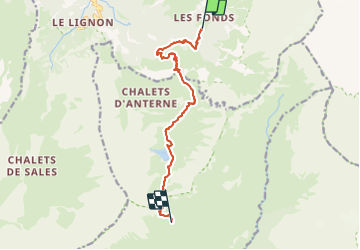

Length
11.3 km

Max alt
2253 m

Uphill gradient
979 m
Km-Effort
22 km

Min alt
1380 m

Downhill gradient
369 m
Boucle
No
Creation date :
2023-09-12 06:47:51.304
Updated on :
2023-09-15 12:20:07.341
4h05
Difficulty : Difficult

FREE GPS app for hiking
 SityTrail
IGN / Geographical institutes
SityTrail Plus
The world is yours!
About
Trail Walking of 11.3 km to be discovered at Auvergne-Rhône-Alpes, Upper Savoy, Sixt-Fer-à-Cheval. This trail is proposed by helmut68.
Photos


Positioning
Country:
France
Region :
Auvergne-Rhône-Alpes
Department/Province :
Upper Savoy
Municipality :
Sixt-Fer-à-Cheval
Location:
Unknown
Start:(Dec)
Start:(UTM)
330567 ; 5098730 (32T) N.
Comments