


Orgeval m

Rando MLC
User
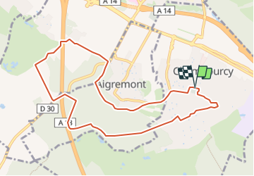

Length
9.6 km

Max alt
178 m

Uphill gradient
183 m
Km-Effort
12 km

Min alt
96 m

Downhill gradient
185 m
Boucle
Yes
Creation date :
2023-09-17 09:07:13.073
Updated on :
2023-09-17 09:15:14.459
2h44
Difficulty : Medium

FREE GPS app for hiking
 SityTrail
IGN / Geographical institutes
SityTrail Plus
The world is yours!
About
Trail Walking of 9.6 km to be discovered at Ile-de-France, Yvelines, Chambourcy. This trail is proposed by Rando MLC.
Positioning
Country:
France
Region :
Ile-de-France
Department/Province :
Yvelines
Municipality :
Chambourcy
Location:
Unknown
Start:(Dec)
Start:(UTM)
429475 ; 5417134 (31U) N.
Comments