


Touille fait 2023

pidjam
User
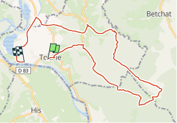

Length
12.4 km

Max alt
460 m

Uphill gradient
236 m
Km-Effort
15.7 km

Min alt
301 m

Downhill gradient
282 m
Boucle
No
Creation date :
2023-09-17 06:46:42.68
Updated on :
2023-09-17 10:37:38.088
3h00
Difficulty : Medium

FREE GPS app for hiking
 SityTrail
IGN / Geographical institutes
SityTrail Plus
The world is yours!
About
Trail Walking of 12.4 km to be discovered at Occitania, Haute-Garonne, Touille. This trail is proposed by pidjam.
Positioning
Country:
France
Region :
Occitania
Department/Province :
Haute-Garonne
Municipality :
Touille
Location:
Unknown
Start:(Dec)
Start:(UTM)
334897 ; 4771644 (31T) N.
Comments