


saint André les Alpes le Chalvet

taguette
User
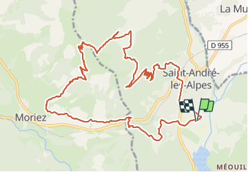

Length
14.7 km

Max alt
1604 m

Uphill gradient
801 m
Km-Effort
25 km

Min alt
883 m

Downhill gradient
799 m
Boucle
Yes
Creation date :
2023-09-17 06:39:55.089
Updated on :
2023-09-17 11:03:26.172
4h20
Difficulty : Very difficult

FREE GPS app for hiking
 SityTrail
IGN / Geographical institutes
SityTrail Plus
The world is yours!
About
Trail Walking of 14.7 km to be discovered at Provence-Alpes-Côte d'Azur, Alpes-de-Haute-Provence, Saint-André-les-Alpes. This trail is proposed by taguette.
Positioning
Country:
France
Region :
Provence-Alpes-Côte d'Azur
Department/Province :
Alpes-de-Haute-Provence
Municipality :
Saint-André-les-Alpes
Location:
Unknown
Start:(Dec)
Start:(UTM)
300300 ; 4870591 (32T) N.
Comments