Trail Walking Presles-en-Brie - Vallée de la Marsange - Photo
© OpenStreetMap contributors
Length
Length
8.6 km
Max alt
Max alt
108 m
Uphill gradient
Uphill gradient
65 m
Km-Effort
Km-Effort  
9.5 km
Min alt
Min alt
79 m
Downhill gradient
Downhill gradient
65 m
Boucle
Boucle
Yes
Creation date :
2023-09-18 07:37:52.279
Updated on :
2023-09-18 07:38:58.303

(0 Reviews)

Walking
Walking
2h08
Difficulty : Medium

Scan this QR Code to open this trail in the SityTrail application

FREE GPS app for hiking

Logo SityTrail SityTrail

IGN / Geographical institutes

Download SityTrail from the App Store Download SityTrail from Google Play

Logo SityTrail SityTrail World

The world is yours!

Download SityTrail from the App Store Download SityTrail from Google Play Download SityTrail on Huawei AppGallery

About

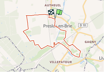
Trail Walking of 8.6 km to be discovered at Ile-de-France, Seine-et-Marne, Presles-en-Brie. This trail is proposed by francoisep.
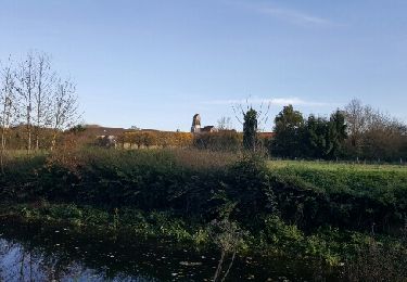
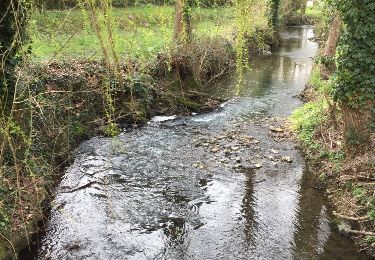
Description

Campagne
Départ /Arrivée : Presles en Brie

Elevation profile

Positioning

Country:
France
Region :
Ile-de-France
Department/Province :
Seine-et-Marne
Municipality :
Presles-en-Brie
Location:
Unknown
Start:(UTM)
480947 ; 5395826 (31U) N.

Trails nearby

Trail Walking Tournan-en-Brie - TOURNAN > VERNEUIL 22 KM - Photo
Walking
gemau77

Walking

Very easy
(1)
Tournan-en-Brie, Ile-de-France, Seine-et-Marne, France
22 km | 25 km-effort
5h 35min
No
Trail On foot Presles-en-Brie - L 11 Presles-en-Brie - Photo
On foot

On foot

Very easy
(2)
Presles-en-Brie, Ile-de-France, Seine-et-Marne, France
7.4 km | 8.4 km-effort
2h 8min
Yes
Trail Walking Tournan-en-Brie - TEM77 2017 - Photo
Walking
Tournan

Walking

Very easy
(1)
Tournan-en-Brie, Ile-de-France, Seine-et-Marne, France
77 km | 85 km-effort
13h 40min
Yes
Trail Walking Coubert - rando de la cueillette  - Photo
Walking
jmv77

Walking

Very easy
Coubert, Ile-de-France, Seine-et-Marne, France
7.7 km | 8.5 km-effort
1h 39min
Yes
Trail Walking Courquetaine - JC 34 Courquetaine, Ozouer le Voulgis - Photo
Walking

Walking

Difficult
Courquetaine, Ile-de-France, Seine-et-Marne, France
18.5 km | 21 km-effort
3h 33min
Yes
Trail Other activity Gretz-Armainvilliers - Gretz Armainvilliers - Photo
Other activity
bellicaud

Other activity

Medium
Gretz-Armainvilliers, Ile-de-France, Seine-et-Marne, France
18.4 km | 19.9 km-effort
5h 33min
Yes
Trail On foot Gretz-Armainvilliers - Arboretum Gretz - Photo
On foot
francoisep

On foot

Easy
Gretz-Armainvilliers, Ile-de-France, Seine-et-Marne, France
6.8 km | 7.6 km-effort
1h 43min
No
Trail Walking Gretz-Armainvilliers - randogps77-99 - Photo
Walking

Walking

Difficult
Gretz-Armainvilliers, Ile-de-France, Seine-et-Marne, France
21 km | 23 km-effort
4h 33min
Yes
Trail Walking Liverdy-en-Brie - Liverdy - Photo
Walking

Walking

Medium
(1)
Liverdy-en-Brie, Ile-de-France, Seine-et-Marne, France
14.3 km | 15.5 km-effort
3h 30min
Yes


Close
My subscriptions