


Plan d'Aups 1370m+

ericberlin
User

Length
66 km

Max alt
692 m

Uphill gradient
1370 m
Km-Effort
84 km

Min alt
205 m

Downhill gradient
1370 m
Boucle
Yes
Creation date :
2023-09-18 15:36:34.074
Updated on :
2023-09-18 15:44:58.714
5h06
Difficulty : Very difficult

FREE GPS app for hiking
 SityTrail
IGN / Geographical institutes
SityTrail Plus
The world is yours!
About
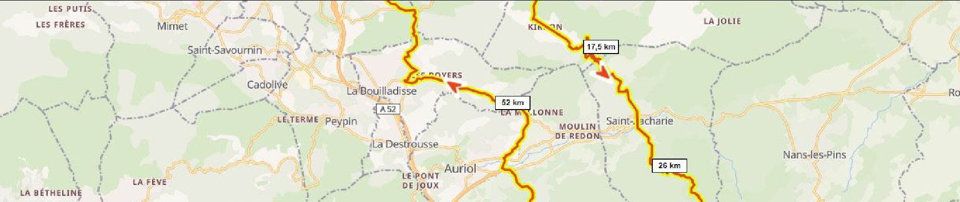
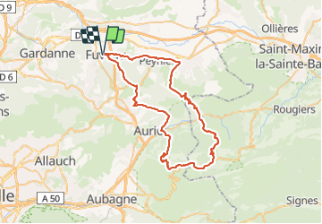
Trail Road bike of 66 km to be discovered at Provence-Alpes-Côte d'Azur, Bouches-du-Rhône, Fuveau. This trail is proposed by ericberlin.
Description
par le petit Galbier ,
retour par le Pigonnier.
Photos

Positioning
Country:
France
Region :
Provence-Alpes-Côte d'Azur
Department/Province :
Bouches-du-Rhône
Municipality :
Fuveau
Location:
Unknown
Start:(Dec)
Start:(UTM)
706987 ; 4814351 (31T) N.
Comments