Trail Walking Arcisses - Brunelles - Autour du Promontoire 10 km - Photo

Brunelles - Autour du Promontoire 10 km

 ODDAD78
ODDAD78

User

© OpenStreetMap contributors
Length
Length
10.1 km
Max alt
Max alt
197 m
Uphill gradient
Uphill gradient
110 m
Km-Effort
Km-Effort  
11.6 km
Min alt
Min alt
152 m
Downhill gradient
Downhill gradient
110 m
Boucle
Boucle
Yes
Creation date :
2023-09-20 06:31:30.236
Updated on :
2023-09-20 17:40:17.65

(0 Reviews)

Walking
Walking
2h37
Difficulty : Medium

Scan this QR Code to open this trail in the SityTrail application

FREE GPS app for hiking

Logo SityTrail SityTrail

IGN / Geographical institutes

Download SityTrail from the App Store Download SityTrail from Google Play

Logo SityTrail SityTrail World

The world is yours!

Download SityTrail from the App Store Download SityTrail from Google Play Download SityTrail on Huawei AppGallery

About

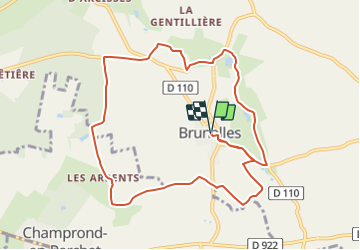
Trail Walking of 10.1 km to be discovered at Centre-Loire Valley, Eure-et-Loir, Arcisses. This trail is proposed by ODDAD78.

Description

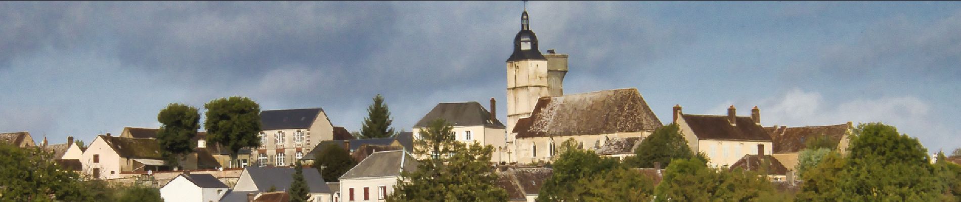
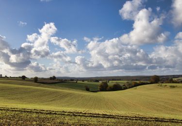
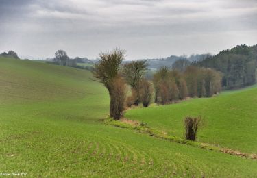
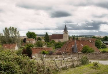
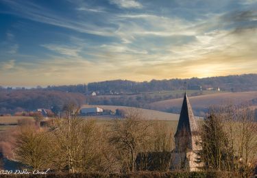
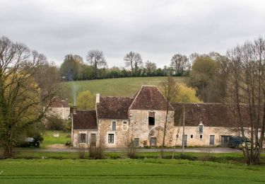
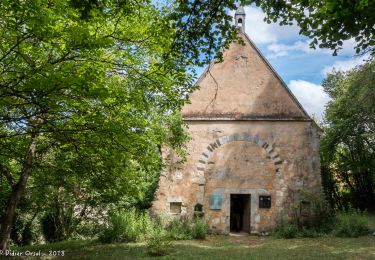
Brunelles est un petit village juché sur une colline qui domine la plaine. Cette randonnée en fait le tour en passant par plusieurs lieux-dits dévoilants une architecture percheronne caractéristique de la région. La trace alterne de manière équilibrée les chemins forestiers, les chemins de plein champs et les panoramas.

Elevation profile

Photos

Positioning

Country:
France
Region :
Centre-Loire Valley
Department/Province :
Eure-et-Loir
Municipality :
Arcisses
Location:
Unknown
Start:(UTM)
343876 ; 5354456 (31U) N.

Trails nearby

Trail Walking Trizay-Coutretot-Saint-Serge - Trizay 100-B - Photo
Walking
togolo28

Walking

Difficult
(2)
Trizay-Coutretot-Saint-Serge, Centre-Loire Valley, Eure-et-Loir, France
48 km | 56 km-effort
12h 1min
Yes
Trail Walking Arcisses - Coudreceau, les panoramas du Perche Eurélien 9,4 km - Photo
Walking
ODDAD78

Walking

Medium
Arcisses, Centre-Loire Valley, Eure-et-Loir, France
9.4 km | 11.4 km-effort
2h 35min
Yes
Trail Walking Arcisses - 2023-04-24_20h15m45_Ozée  9,1 km - Photo
Walking
ODDAD78

Walking

Medium
(1)
Arcisses, Centre-Loire Valley, Eure-et-Loir, France
9.1 km | 11.2 km-effort
2h 32min
Yes
Trail Walking La Gaudaine - La Gaudaine - les panoramas 12 km - Photo
Walking
ODDAD78

Walking

Easy
La Gaudaine, Centre-Loire Valley, Eure-et-Loir, France
11.9 km | 14.9 km-effort
5min
Yes
Trail Walking Marolles-les-Buis - SityTrail - Le hameau de la Cloche 7,4 km - Photo
Walking
ODDAD78

Walking

Medium
Marolles-les-Buis, Centre-Loire Valley, Eure-et-Loir, France
8.1 km | 10.4 km-effort
2h 21min
Yes
Trail Walking Arcisses - Coudreceau - Saint-Victor-de-Buthon 11 km - Photo
Walking

Walking

Easy
Arcisses, Centre-Loire Valley, Eure-et-Loir, France
11.6 km | 14.3 km-effort
3h 6min
No
Trail Walking Arcisses - Coudreceau - Nogent-le-Rotrou 11 km - Photo
Walking

Walking

Easy
Arcisses, Centre-Loire Valley, Eure-et-Loir, France
11.2 km | 13.2 km-effort
5h 23min
No
Trail Walking Arcisses - Coudreceau - Thiron-Gardais 9,2 km - Photo
Walking

Walking

Easy
Arcisses, Centre-Loire Valley, Eure-et-Loir, France
9.2 km | 11 km-effort
5h 23min
No
Trail Walking La Gaudaine - La Gaudaine 20 - Photo
Walking
togolo28

Walking

Medium
(2)
La Gaudaine, Centre-Loire Valley, Eure-et-Loir, France
19.9 km | 25 km-effort
5h 22min
Yes


Close
My subscriptions