


GR_34_CB_15_Lamballe_Yffiniac_20230922

patrickdanilo
User

Length
17 km

Max alt
64 m

Uphill gradient
260 m
Km-Effort
20 km

Min alt
-1 m

Downhill gradient
269 m
Boucle
No
Creation date :
2023-09-22 08:28:33.643
Updated on :
2024-03-19 20:01:52.182
4h38
Difficulty : Very difficult

FREE GPS app for hiking
 SityTrail
IGN / Geographical institutes
SityTrail Plus
The world is yours!
About
Trail Walking of 17 km to be discovered at Brittany, Côtes-d'Armor, Lamballe-Armor. This trail is proposed by patrickdanilo.
Description
Randonnée Marche de 16,7 km à découvrir à Bretagne, Côtes-d'Armor, Lamballe-Armor. Cette randonnée est proposée par patrickdanilo.
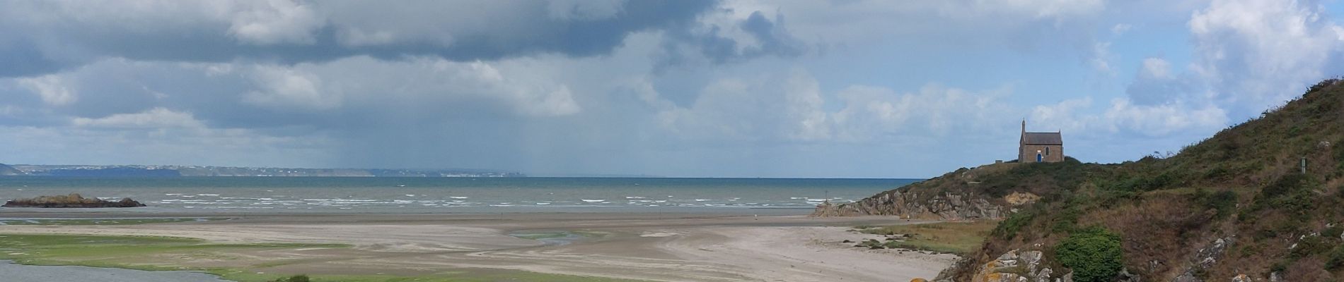
Photos


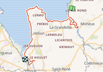
Positioning
Country:
France
Region :
Brittany
Department/Province :
Côtes-d'Armor
Municipality :
Lamballe-Armor
Location:
Morieux
Start:(Dec)
Start:(UTM)
527178 ; 5375178 (30U) N.
Comments