


Le tour du lac roco

ninia
User
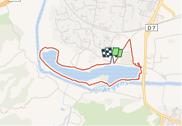

Length
4.2 km

Max alt
14 m

Uphill gradient
17 m
Km-Effort
4.4 km

Min alt
7 m

Downhill gradient
19 m
Boucle
Yes
Creation date :
2023-09-23 06:44:23.652
Updated on :
2023-09-23 08:23:07.712
1h37
Difficulty : Very easy

FREE GPS app for hiking
 SityTrail
IGN / Geographical institutes
SityTrail Plus
The world is yours!
About
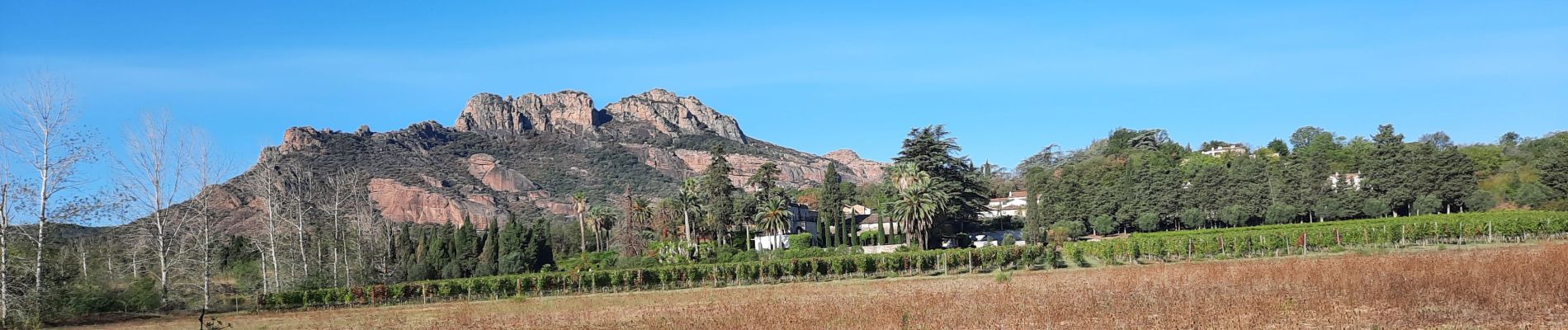
Trail Walking of 4.2 km to be discovered at Provence-Alpes-Côte d'Azur, Var, Roquebrune-sur-Argens. This trail is proposed by ninia.
Photos


Positioning
Country:
France
Region :
Provence-Alpes-Côte d'Azur
Department/Province :
Var
Municipality :
Roquebrune-sur-Argens
Location:
Unknown
Start:(Dec)
Start:(UTM)
308040 ; 4813768 (32T) N.
Comments