


GR_34_CC_16_Yffiniac_Plerin_20230923

patrickdanilo
User
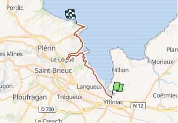

Length
16.2 km

Max alt
73 m

Uphill gradient
247 m
Km-Effort
19.5 km

Min alt
3 m

Downhill gradient
235 m
Boucle
No
Creation date :
2023-09-23 07:44:09.016
Updated on :
2023-09-25 11:48:51.085
3h47
Difficulty : Easy

FREE GPS app for hiking
 SityTrail
IGN / Geographical institutes
SityTrail Plus
The world is yours!
About
Trail Walking of 16.2 km to be discovered at Brittany, Côtes-d'Armor, Yffiniac. This trail is proposed by patrickdanilo.
Description
Randonnée Marche de 16,2 km à découvrir à Bretagne, Côtes-d'Armor, Yffiniac. Cette randonnée est proposée par patrickdanilo.
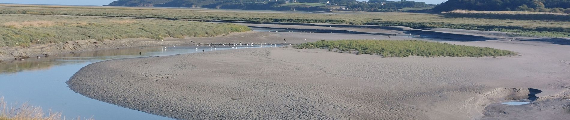
Photos


Positioning
Country:
France
Region :
Brittany
Department/Province :
Côtes-d'Armor
Municipality :
Yffiniac
Location:
Unknown
Start:(Dec)
Start:(UTM)
523729 ; 5370678 (30U) N.
Comments