


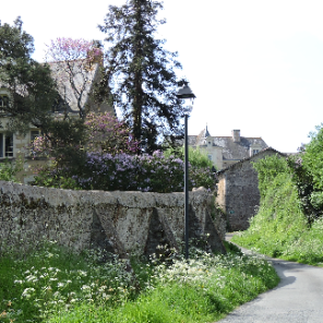
St Rémy la Varenne
L'Anjou en rando
Découvrir ou redécouvrir l'Anjou
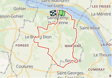

Length
16.8 km

Max alt
81 m

Uphill gradient
193 m
Km-Effort
19.4 km

Min alt
14 m

Downhill gradient
193 m
Boucle
Yes
Creation date :
2023-09-24 05:36:34.633
Updated on :
2023-09-24 12:53:41.576
4h24
Difficulty : Very difficult

FREE GPS app for hiking
 SityTrail
IGN / Geographical institutes
SityTrail Plus
The world is yours!
About
Trail Walking of 16.8 km to be discovered at Pays de la Loire, Maine-et-Loire, Brissac-Loire-Aubance. This trail is proposed by L'Anjou en rando.
Photos


Positioning
Country:
France
Region :
Pays de la Loire
Department/Province :
Maine-et-Loire
Municipality :
Brissac-Loire-Aubance
Location:
Unknown
Start:(Dec)
Start:(UTM)
702371 ; 5252751 (30T) N.
Comments