


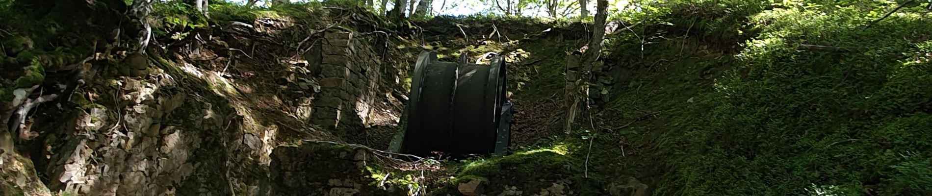
tunnels du Biros ou sentier Decauville

chrisgps
User

Length
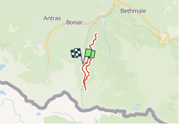
17.8 km

Max alt
1391 m

Uphill gradient
842 m
Km-Effort
29 km

Min alt
892 m

Downhill gradient
844 m
Boucle
Yes
Creation date :
2023-09-24 07:34:00.493
Updated on :
2023-09-25 13:51:47.272
6h35
Difficulty : Very difficult

FREE GPS app for hiking
 SityTrail
IGN / Geographical institutes
SityTrail Plus
The world is yours!
About
Trail Walking of 17.8 km to be discovered at Occitania, Ariège, Bonac-Irazein. This trail is proposed by chrisgps.
Description
en boucle, avec petite extension jusqu' à Fontaine Rouge
Photos


Positioning
Country:
France
Region :
Occitania
Department/Province :
Ariège
Municipality :
Bonac-Irazein
Location:
Unknown
Start:(Dec)
Start:(UTM)
335454 ; 4744336 (31T) N.
Comments