


fruitiere

DuMarsan
User
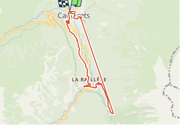

Length
9.2 km

Max alt
1335 m

Uphill gradient
448 m
Km-Effort
15.1 km

Min alt
918 m

Downhill gradient
451 m
Boucle
Yes
Creation date :
2023-09-24 12:23:39.616
Updated on :
2023-09-24 17:40:40.691
5h16
Difficulty : Difficult

FREE GPS app for hiking
 SityTrail
IGN / Geographical institutes
SityTrail Plus
The world is yours!
About
Trail Walking of 9.2 km to be discovered at Occitania, Hautespyrenees, Cauterets. This trail is proposed by DuMarsan.
Positioning
Country:
France
Region :
Occitania
Department/Province :
Hautespyrenees
Municipality :
Cauterets
Location:
Unknown
Start:(Dec)
Start:(UTM)
735505 ; 4752637 (30T) N.
Comments