


PEYRIAC DE MER en boucle

chrisgps
User
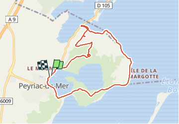

Length
9.5 km

Max alt
67 m

Uphill gradient
127 m
Km-Effort
11.2 km

Min alt
0 m

Downhill gradient
128 m
Boucle
Yes
Creation date :
2023-09-28 08:18:23.274
Updated on :
2023-09-29 14:43:34.685
2h50
Difficulty : Very easy

FREE GPS app for hiking
 SityTrail
IGN / Geographical institutes
SityTrail Plus
The world is yours!
About
Trail Walking of 9.5 km to be discovered at Occitania, Aude, Peyriac-de-Mer. This trail is proposed by chrisgps.
Description
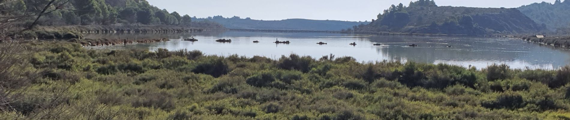
autour des étangs de Doul et de Sel Fort, en bordure des étangs de Bages et de Sigean
Photos


Positioning
Country:
France
Region :
Occitania
Department/Province :
Aude
Municipality :
Peyriac-de-Mer
Location:
Unknown
Start:(Dec)
Start:(UTM)
496798 ; 4770864 (31T) N.
Comments