


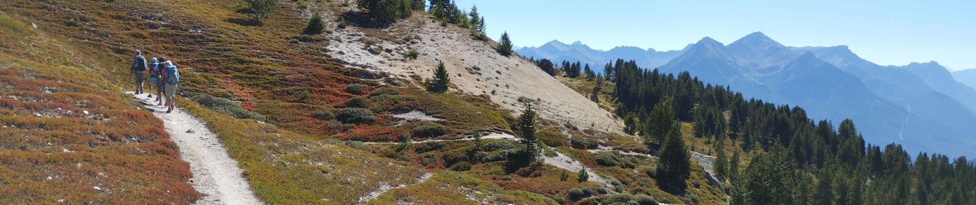
crête de Peyrolles

orsel
User GUIDE
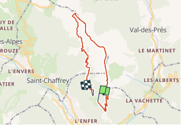

Length
15.8 km

Max alt
2623 m

Uphill gradient
912 m
Km-Effort
28 km

Min alt
1836 m

Downhill gradient
969 m
Boucle
No
Creation date :
2023-09-29 06:53:37.522
Updated on :
2023-09-29 14:57:17.491
7h02
Difficulty : Medium

FREE GPS app for hiking
 SityTrail
IGN / Geographical institutes
SityTrail Plus
The world is yours!
About
Trail Walking of 15.8 km to be discovered at Provence-Alpes-Côte d'Azur, Hautes-Alpes, Briançon. This trail is proposed by orsel.
Photos


Positioning
Country:
France
Region :
Provence-Alpes-Côte d'Azur
Department/Province :
Hautes-Alpes
Municipality :
Briançon
Location:
Unknown
Start:(Dec)
Start:(UTM)
313833 ; 4976303 (32T) N.
Comments