


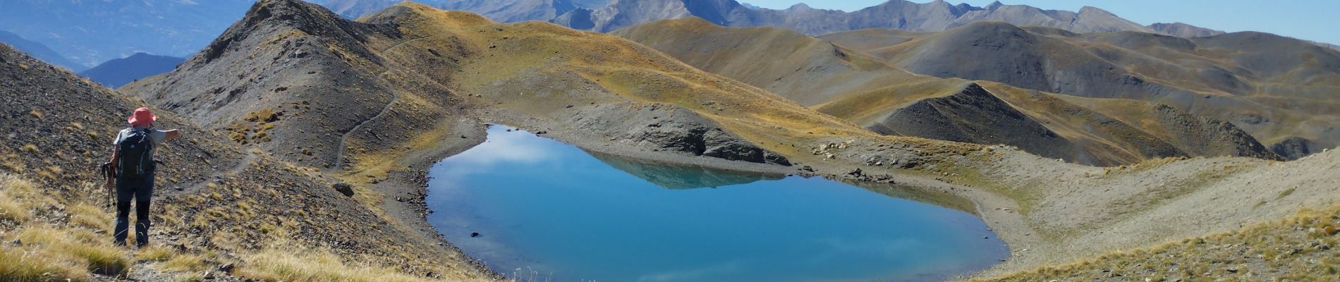
crête des Couniets, lac de l'étoile

orsel
User GUIDE
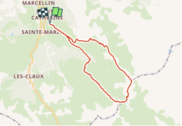

Length
15.6 km

Max alt
2806 m

Uphill gradient
990 m
Km-Effort
29 km

Min alt
1849 m

Downhill gradient
983 m
Boucle
Yes
Creation date :
2023-09-30 06:26:30.086
Updated on :
2023-09-30 19:00:46.35
7h32
Difficulty : Medium

FREE GPS app for hiking
 SityTrail
IGN / Geographical institutes
SityTrail Plus
The world is yours!
About
Trail Walking of 15.6 km to be discovered at Provence-Alpes-Côte d'Azur, Hautes-Alpes, Vars. This trail is proposed by orsel.
Photos


Positioning
Country:
France
Region :
Provence-Alpes-Côte d'Azur
Department/Province :
Hautes-Alpes
Municipality :
Vars
Location:
Unknown
Start:(Dec)
Start:(UTM)
317173 ; 4940915 (32T) N.
Comments