


Pic St Michel

GOHIER
User
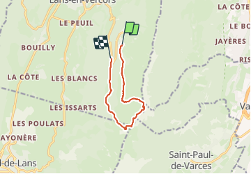

Length
9 km

Max alt
1965 m

Uphill gradient
538 m
Km-Effort
16.6 km

Min alt
1294 m

Downhill gradient
655 m
Boucle
No
Creation date :
2023-10-01 08:44:36.0
Updated on :
2023-10-01 14:11:37.201
4h45
Difficulty : Easy

FREE GPS app for hiking
 SityTrail
IGN / Geographical institutes
SityTrail Plus
The world is yours!
About
Trail Walking of 9 km to be discovered at Auvergne-Rhône-Alpes, Isère, Lans-en-Vercors. This trail is proposed by GOHIER.
Description
En traversée boucle par les Allieres.
Positioning
Country:
France
Region :
Auvergne-Rhône-Alpes
Department/Province :
Isère
Municipality :
Lans-en-Vercors
Location:
Unknown
Start:(Dec)
Start:(UTM)
705223 ; 4998692 (31T) N.
Comments