


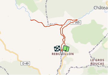
Rebouillon Nartuby d'Ampus

aljac
User

Length
8.4 km

Max alt
452 m

Uphill gradient
328 m
Km-Effort
12.8 km

Min alt
228 m

Downhill gradient
327 m
Boucle
Yes
Creation date :
2023-10-03 11:48:21.13
Updated on :
2023-10-03 14:53:14.468
3h03
Difficulty : Easy

FREE GPS app for hiking
 SityTrail
IGN / Geographical institutes
SityTrail Plus
The world is yours!
About
Trail Walking of 8.4 km to be discovered at Provence-Alpes-Côte d'Azur, Var, Châteaudouble. This trail is proposed by aljac.
Description
Reco le long de la Nartuby d'Ampus.
Positioning
Country:
France
Region :
Provence-Alpes-Côte d'Azur
Department/Province :
Var
Municipality :
Châteaudouble
Location:
Unknown
Start:(Dec)
Start:(UTM)
292008 ; 4828077 (32T) N.
Comments