


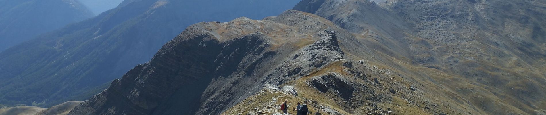
pointe de l'Eyssina

orsel
User GUIDE
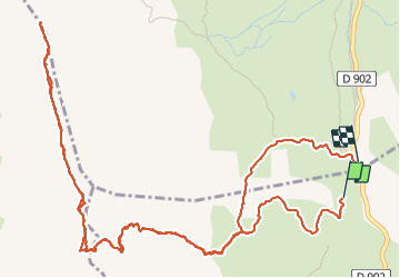

Length
8.7 km

Max alt
2807 m

Uphill gradient
701 m
Km-Effort
18 km

Min alt
2100 m

Downhill gradient
698 m
Boucle
No
Creation date :
2023-10-04 07:16:16.394
Updated on :
2023-10-04 15:11:47.145
6h54
Difficulty : Medium

FREE GPS app for hiking
 SityTrail
IGN / Geographical institutes
SityTrail Plus
The world is yours!
About
Trail Walking of 8.7 km to be discovered at Provence-Alpes-Côte d'Azur, Alpes-de-Haute-Provence, Saint-Paul-sur-Ubaye. This trail is proposed by orsel.
Description
Des patous sur le trajet nous ont obligés à faire un détour à la descente
Photos


Positioning
Country:
France
Region :
Provence-Alpes-Côte d'Azur
Department/Province :
Alpes-de-Haute-Provence
Municipality :
Saint-Paul-sur-Ubaye
Location:
Unknown
Start:(Dec)
Start:(UTM)
317389 ; 4934111 (32T) N.
Comments