


Thieusies - Gottignies - St Denis - 16kms

CapTom
User
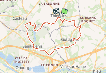

Length
16.2 km

Max alt
123 m

Uphill gradient
234 m
Km-Effort
19.4 km

Min alt
51 m

Downhill gradient
235 m
Boucle
Yes
Creation date :
2023-10-06 08:02:42.709
Updated on :
2023-10-06 10:41:30.7
4h24
Difficulty : Easy

FREE GPS app for hiking
 SityTrail
IGN / Geographical institutes
SityTrail Plus
The world is yours!
About
Trail Walking of 16.2 km to be discovered at Wallonia, Hainaut, Soignies. This trail is proposed by CapTom.
Positioning
Country:
Belgium
Region :
Wallonia
Department/Province :
Hainaut
Municipality :
Soignies
Location:
Unknown
Start:(Dec)
Start:(UTM)
574487 ; 5596212 (31U) N.
Comments