Trail Walking Bernay-Vilbert - Le long de l'Yerres autour de Bernay-Vilbert - Photo

Le long de l'Yerres autour de Bernay-Vilbert

Le mercredi c'est rando

© OpenStreetMap contributors
Length
Length
7.5 km
Max alt
Max alt
104 m
Uphill gradient
Uphill gradient
82 m
Km-Effort
Km-Effort  
8.6 km
Min alt
Min alt
77 m
Downhill gradient
Downhill gradient
83 m
Boucle
Boucle
Yes
Creation date :
2023-10-08 11:11:59.732
Updated on :
2023-10-08 11:13:55.457

(0 Reviews)

Walking
Walking
1h57
Difficulty : Medium

Scan this QR Code to open this trail in the SityTrail application

FREE GPS app for hiking

Logo SityTrail SityTrail

IGN / Geographical institutes

Download SityTrail from the App Store Download SityTrail from Google Play

Logo SityTrail SityTrail World

The world is yours!

Download SityTrail from the App Store Download SityTrail from Google Play Download SityTrail on Huawei AppGallery

About

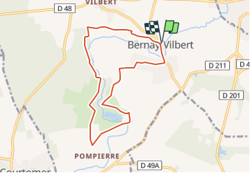
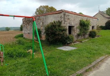
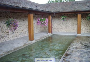
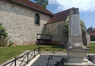
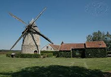
Trail Walking of 7.5 km to be discovered at Ile-de-France, Seine-et-Marne, Bernay-Vilbert. This trail is proposed by Randos du mercredi.

Description

marche AM

Elevation profile

Points of interest

Point of interest Bernay-Vilbert - Parking de l'église - Photo
CL48
BERNAY-VILBERT 
Point of interest Bernay-Vilbert - Débouché du chemin. Vers l' - Photo
CL48
Point of interest Bernay-Vilbert - Croisement en T - Photo
CL48
BERNAY-VILBERT 
Point of interest Bernay-Vilbert - Coude - Photo
CL48
BERNAY-VILBERT 
Point of interest Bernay-Vilbert - Intersection en T - Photo
CL48
BERNAY-VILBERT 
Point of interest Bernay-Vilbert - Pompierre - Photo
CL48
BERNAY-VILBERT 
Point of interest Bernay-Vilbert - Les Trous Guillot - Photo
CL48
BERNAY-VILBERT 
Point of interest Bernay-Vilbert - Croisement - Photo
CL48
BERNAY-VILBERT 
Point of interest Bernay-Vilbert - Intersection en T - Photo
CL48
BERNAY-VILBERT 
Point of interest Bernay-Vilbert - Parking de l'église - Photo
CL48
BERNAY-VILBERT 

Positioning

Country:
France
Region :
Ile-de-France
Department/Province :
Seine-et-Marne
Municipality :
Bernay-Vilbert
Location:
Unknown
Start:(UTM)
495445 ; 5391508 (31U) N.

Trails nearby

Trail Walking Courtomer - Boucle Courtomer - chaumes en Brie -  - Photo
Walking
chessyca

Walking

Easy
Courtomer, Ile-de-France, Seine-et-Marne, France
20 km | 23 km-effort
4h 34min
Yes
Trail Walking Bernay-Vilbert - Boucle de Bernay - Photo
Walking
pikibangi

Walking

Medium
Bernay-Vilbert, Ile-de-France, Seine-et-Marne, France
7.9 km | 9 km-effort
2h 6min
Yes
Trail Walking Lumigny-Nesles-Ormeaux - Tour de Lumigny - Nesles - Ormeaux - Photo
Walking
tracegps

Walking

Very difficult
Lumigny-Nesles-Ormeaux, Ile-de-France, Seine-et-Marne, France
16.8 km | 18.4 km-effort
4h 10min
Yes
Trail Walking La Chapelle-Iger - Les côteaux Capelligérois - La Chapelle-Iger - Photo
Walking
tracegps

Walking

Difficult
La Chapelle-Iger, Ile-de-France, Seine-et-Marne, France
13.5 km | 15.3 km-effort
3h 19min
Yes
Trail Walking Courpalay - courpalay - Photo
Walking
gobechemins

Walking

Easy
(1)
Courpalay, Ile-de-France, Seine-et-Marne, France
13.7 km | 15.3 km-effort
3h 20min
Yes
Trail Walking Courpalay - Courpalay  - Photo
Walking
pikibangi

Walking

Medium
Courpalay, Ile-de-France, Seine-et-Marne, France
8.6 km | 9.8 km-effort
2h 39min
Yes
Trail Walking Courpalay - SityTrail - J 96 - Randonnées des lavoirs - 19 km - Photo
Walking

Walking

Difficult
Courpalay, Ile-de-France, Seine-et-Marne, France
19.2 km | 22 km-effort
4h 58min
Yes
Trail Walking La Chapelle-Iger - Chapelle Iger - Photo
Walking
pikibangi

Walking

Medium
La Chapelle-Iger, Ile-de-France, Seine-et-Marne, France
10.2 km | 11.4 km-effort
2h 3min
Yes
Trail Walking La Chapelle-Iger - la chapelle Iger - Photo
Walking

Walking

Difficult
La Chapelle-Iger, Ile-de-France, Seine-et-Marne, France
18.8 km | 21 km-effort
4h 18min
Yes


Close
My subscriptions