


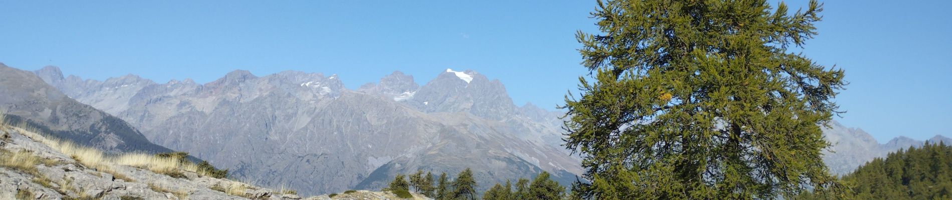
Les Têtes et tête d'Oréac

orsel
User GUIDE
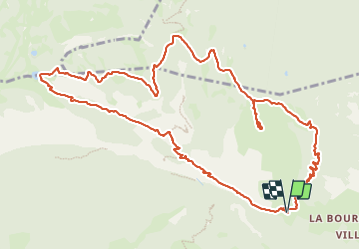

Length
14.8 km

Max alt
2074 m

Uphill gradient
1086 m
Km-Effort
29 km

Min alt
1240 m

Downhill gradient
1093 m
Boucle
Yes
Creation date :
2023-10-08 06:56:01.459
Updated on :
2023-10-08 15:21:10.747
6h23
Difficulty : Medium

FREE GPS app for hiking
 SityTrail
IGN / Geographical institutes
SityTrail Plus
The world is yours!
About
Trail Walking of 14.8 km to be discovered at Provence-Alpes-Côte d'Azur, Hautes-Alpes, L'Argentière-la-Bessée. This trail is proposed by orsel.
Photos


Positioning
Country:
France
Region :
Provence-Alpes-Côte d'Azur
Department/Province :
Hautes-Alpes
Municipality :
L'Argentière-la-Bessée
Location:
Unknown
Start:(Dec)
Start:(UTM)
304888 ; 4962290 (32T) N.
Comments