


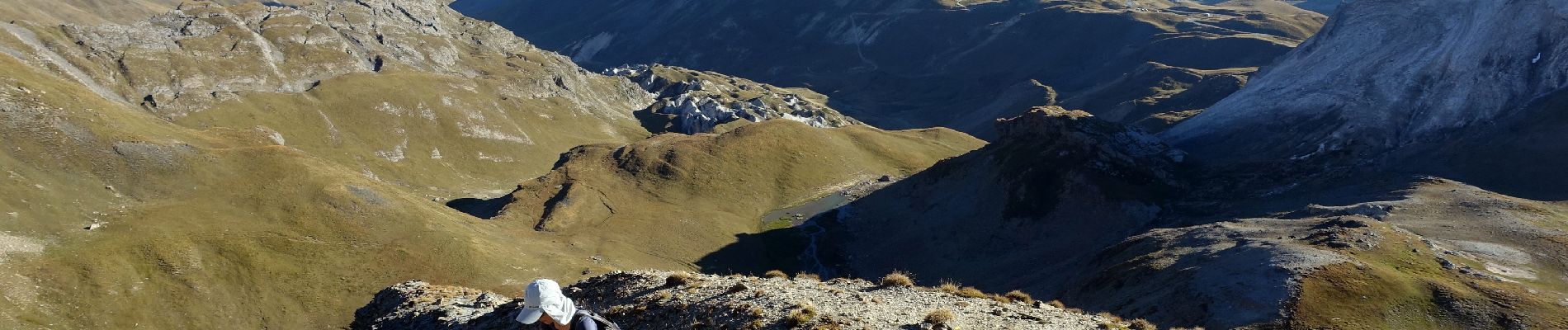
Pic Blanc-2023

Valmeinier
User
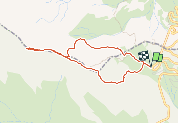

Length
4.6 km

Max alt
2924 m

Uphill gradient
426 m
Km-Effort
10.3 km

Min alt
2542 m

Downhill gradient
422 m
Boucle
Yes
Creation date :
2023-10-09 09:28:34.988
Updated on :
2023-10-09 09:39:40.468
2h20
Difficulty : Medium

FREE GPS app for hiking
 SityTrail
IGN / Geographical institutes
SityTrail Plus
The world is yours!
About
Trail Walking of 4.6 km to be discovered at Provence-Alpes-Côte d'Azur, Hautes-Alpes, Le Monêtier-les-Bains. This trail is proposed by Valmeinier.
Photos


Positioning
Country:
France
Region :
Provence-Alpes-Côte d'Azur
Department/Province :
Hautes-Alpes
Municipality :
Le Monêtier-les-Bains
Location:
Unknown
Start:(Dec)
Start:(UTM)
295729 ; 4993081 (32T) N.
Comments