Trail Walking Cadalen - Les clochers court 2  - Photo

Les clochers court 2

© OpenStreetMap contributors
Length
Length
8.3 km
Max alt
Max alt
324 m
Uphill gradient
Uphill gradient
185 m
Km-Effort
Km-Effort  
10.8 km
Min alt
Min alt
208 m
Downhill gradient
Downhill gradient
183 m
Boucle
Boucle
Yes
Creation date :
2023-10-09 07:25:02.828
Updated on :
2023-10-09 13:03:46.617

(0 Reviews)

Walking
Walking
2h27
Difficulty : Medium

Scan this QR Code to open this trail in the SityTrail application

FREE GPS app for hiking

Logo SityTrail SityTrail

IGN / Geographical institutes

Download SityTrail from the App Store Download SityTrail from Google Play

Logo SityTrail SityTrail World

The world is yours!

Download SityTrail from the App Store Download SityTrail from Google Play Download SityTrail on Huawei AppGallery

About

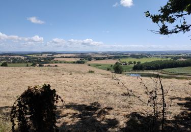
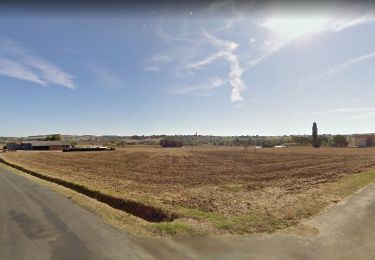
Trail Walking of 8.3 km to be discovered at Occitania, Tarn, Cadalen. This trail is proposed by jpipacific.

Description

Balade sympa avec de jolis points de vue.
Pas de difficulté particulière.

Elevation profile

Photos

Positioning

Country:
France
Region :
Occitania
Department/Province :
Tarn
Municipality :
Cadalen
Location:
Unknown
Start:(UTM)
416958 ; 4853584 (31T) N.

Trails nearby

Trail Walking Cadalen - Les clochers court 1 - Photo
Walking
jpipacific

Walking

Medium
Cadalen, Occitania, Tarn, France
7.1 km | 9.5 km-effort
2h 9min
Yes
Trail Walking Aussac - Fontbounal Paradis - Photo
Walking
jpipacific

Walking

Very easy
Aussac, Occitania, Tarn, France
5.5 km | 6.3 km-effort
1h 33min
Yes
Trail Walking Cadalen - rando autour des vignes de Rotier - Photo
Walking
jpipacific

Walking

Very easy
Cadalen, Occitania, Tarn, France
6 km | 7.3 km-effort
1h 34min
Yes
Trail Walking Labessière-Candeil - Labessière Candeil 01 2018 - Photo
Walking
jpipacific

Walking

Easy
Labessière-Candeil, Occitania, Tarn, France
6.5 km | 8.4 km-effort
1h 24min
Yes
Trail Walking Cadalen - Puech de Cals - Photo
Walking
jpipacific

Walking

Very easy
(1)
Cadalen, Occitania, Tarn, France
5.3 km | 6.1 km-effort
1h 18min
Yes
Trail Walking Técou - recouvrir 2024 - Photo
Walking
Frayssinet

Walking

Very difficult
Técou, Occitania, Tarn, France
19.8 km | 24 km-effort
5h 34min
Yes
Trail Walking Técou - Tecou - Photo
Walking
pb07

Walking

Easy
Técou, Occitania, Tarn, France
22 km | 26 km-effort
4h 23min
No
Trail Nordic walking Técou - Tecou - Photo
Nordic walking
chripaci

Nordic walking

Easy
Técou, Occitania, Tarn, France
10.5 km | 13.5 km-effort
2h 20min
Yes
Trail Nordic walking Busque - Embusquade 2023 - Photo
Nordic walking
01730311

Nordic walking

Busque, Occitania, Tarn, France
9.6 km | 12.7 km-effort
1h 34min
Yes


Close
My subscriptions