


poix terron.2023.10.10

trusgnachjf
User
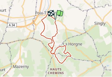

Length
15.1 km

Max alt
305 m

Uphill gradient
292 m
Km-Effort
19 km

Min alt
176 m

Downhill gradient
291 m
Boucle
Yes
Creation date :
2023-10-10 11:42:18.476
Updated on :
2023-10-10 15:22:35.287
3h39
Difficulty : Difficult

FREE GPS app for hiking
 SityTrail
IGN / Geographical institutes
SityTrail Plus
The world is yours!
About
Trail Walking of 15.1 km to be discovered at Grand Est, Ardennes, Poix-Terron. This trail is proposed by trusgnachjf.
Positioning
Country:
France
Region :
Grand Est
Department/Province :
Ardennes
Municipality :
Poix-Terron
Location:
Unknown
Start:(Dec)
Start:(UTM)
619185 ; 5500373 (31U) N.
Comments