


20231011 Montroc Le Tour

Childebert
User

Length
3 km

Max alt
1558 m

Uphill gradient
187 m
Km-Effort
5.2 km

Min alt
1368 m

Downhill gradient
98 m
Boucle
No
Creation date :
2023-10-11 11:45:49.748
Updated on :
2023-10-11 13:34:49.72
1h48
Difficulty : Medium

FREE GPS app for hiking
 SityTrail
IGN / Geographical institutes
SityTrail Plus
The world is yours!
About
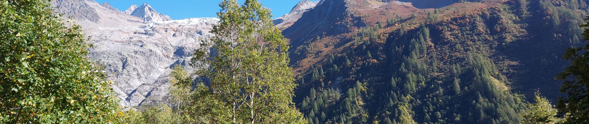
Trail Walking of 3 km to be discovered at Auvergne-Rhône-Alpes, Upper Savoy, Chamonix-Mont-Blanc. This trail is proposed by Childebert.
Photos


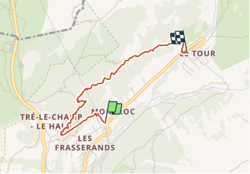
Positioning
Country:
France
Region :
Auvergne-Rhône-Alpes
Department/Province :
Upper Savoy
Municipality :
Chamonix-Mont-Blanc
Location:
Unknown
Start:(Dec)
Start:(UTM)
340057 ; 5095755 (32T) N.
Comments