


les caires

ARPF
User
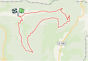

Length
11.8 km

Max alt
798 m

Uphill gradient
572 m
Km-Effort
19.4 km

Min alt
421 m

Downhill gradient
582 m
Boucle
Yes
Creation date :
2023-10-11 16:17:24.826
Updated on :
2023-10-11 16:17:27.814
4h24
Difficulty : Medium

FREE GPS app for hiking
 SityTrail
IGN / Geographical institutes
SityTrail Plus
The world is yours!
About
Trail Walking of 11.8 km to be discovered at Auvergne-Rhône-Alpes, Drôme, Combovin. This trail is proposed by ARPF.
Positioning
Country:
France
Region :
Auvergne-Rhône-Alpes
Department/Province :
Drôme
Municipality :
Combovin
Location:
Unknown
Start:(Dec)
Start:(UTM)
665706 ; 4971354 (31T) N.
Comments
très bien