


gouter

mikaelerouzic
User
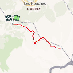

Length
15.1 km

Max alt
3766 m

Uphill gradient
1964 m
Km-Effort
41 km

Min alt
1770 m

Downhill gradient
1964 m
Boucle
Yes
Creation date :
2015-02-06 00:00:00.0
Updated on :
2015-02-06 00:00:00.0
5h00
Difficulty : Difficult

FREE GPS app for hiking
 SityTrail
IGN / Geographical institutes
SityTrail Plus
The world is yours!
About
Trail Walking of 15.1 km to be discovered at Auvergne-Rhône-Alpes, Upper Savoy, Saint-Gervais-les-Bains. This trail is proposed by mikaelerouzic.
Positioning
Country:
France
Region :
Auvergne-Rhône-Alpes
Department/Province :
Upper Savoy
Municipality :
Saint-Gervais-les-Bains
Location:
Unknown
Start:(Dec)
Start:(UTM)
327116 ; 5082424 (32T) N.
Comments