


2023-10-13_16h14m55_SityTrail - 795767 - lardy

Catherine de Brunoy
User
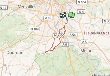

Length
73 km

Max alt
96 m

Uphill gradient
596 m
Km-Effort
81 km

Min alt
25 m

Downhill gradient
596 m
Boucle
Yes
Creation date :
2023-10-13 14:14:56.002
Updated on :
2023-10-13 14:14:55.678

FREE GPS app for hiking
 SityTrail
IGN / Geographical institutes
SityTrail Plus
The world is yours!
About
Trail of 73 km to be discovered at Ile-de-France, Essonne, Yerres. This trail is proposed by Catherine de Brunoy.
Positioning
Country:
France
Region :
Ile-de-France
Department/Province :
Essonne
Municipality :
Yerres
Location:
Unknown
Start:(Dec)
Start:(UTM)
462410 ; 5395760 (31U) N.
Comments