Trail Walking Thurins - thurins la chap. château neuf st Laurent de vaux - Photo

thurins la chap. château neuf st Laurent de vaux

 maclobar
maclobar

User

© OpenStreetMap contributors
Length
Length
15.3 km
Max alt
Max alt
723 m
Uphill gradient
Uphill gradient
614 m
Km-Effort
Km-Effort  
24 km
Min alt
Min alt
375 m
Downhill gradient
Downhill gradient
614 m
Boucle
Boucle
Yes
Creation date :
2023-10-13 10:26:16.727
Updated on :
2023-10-13 19:21:48.557

(0 Reviews)

Walking
Walking
3h37
Difficulty : Very difficult

Scan this QR Code to open this trail in the SityTrail application

FREE GPS app for hiking

Logo SityTrail SityTrail

IGN / Geographical institutes

Download SityTrail from the App Store Download SityTrail from Google Play

Logo SityTrail SityTrail World

The world is yours!

Download SityTrail from the App Store Download SityTrail from Google Play Download SityTrail on Huawei AppGallery

About

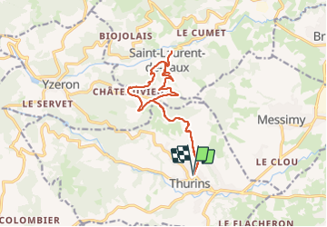
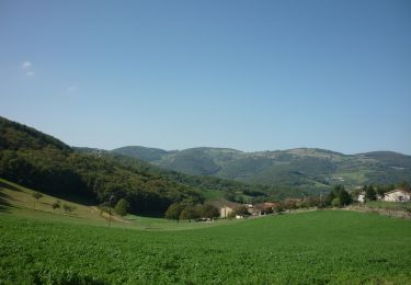
Trail Walking of 15.3 km to be discovered at Auvergne-Rhône-Alpes, Rhône, Thurins. This trail is proposed by maclobar.

Description

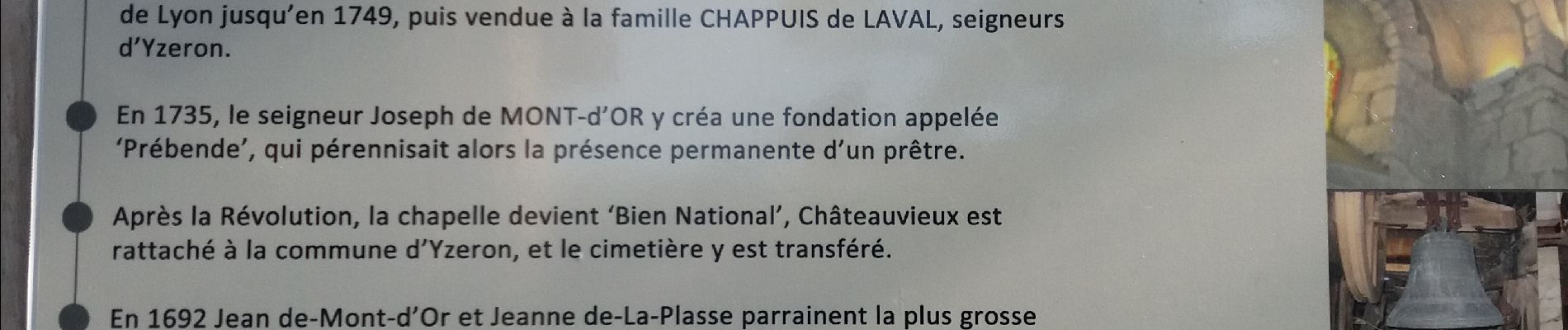
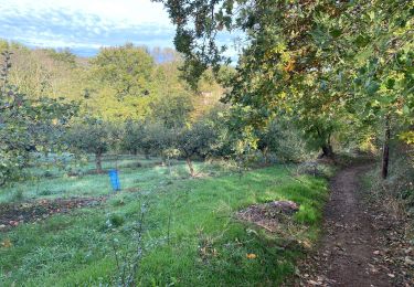
Randonnée agréable dans les bois. Un peu de goudron. Montée à l'aller surtout jusqu'à la Chapelle Chateauvieux

Elevation profile

Photos

Positioning

Country:
France
Region :
Auvergne-Rhône-Alpes
Department/Province :
Rhône
Municipality :
Thurins
Location:
Unknown
Start:(UTM)
627771 ; 5060207 (31T) N.

Trails nearby

Trail Walking Messimy - De Messimy au belvédère du Piragoy en boucle - Photo
Walking
galain

Walking

Easy
(1)
Messimy, Auvergne-Rhône-Alpes, Rhône, France
9.6 km | 13.6 km-effort
2h 31min
Yes
Trail Walking Thurins - tour du bois du baron - Photo
Walking
godbillon

Walking

Easy
(3)
Thurins, Auvergne-Rhône-Alpes, Rhône, France
7.4 km | 11.5 km-effort
1h 40min
Yes
Trail Mountain bike Messimy - monté technique - Photo
Mountain bike
journoud

Mountain bike

Difficult
(1)
Messimy, Auvergne-Rhône-Alpes, Rhône, France
26 km | 41 km-effort
3h 15min
Yes
Trail Walking Yzeron - Yzeron - Les terres de Barmont - Photo
Walking
tracegps

Walking

Difficult
(1)
Yzeron, Auvergne-Rhône-Alpes, Rhône, France
11.3 km | 15.4 km-effort
2h 45min
Yes
Trail Walking Messimy - messimy. thurins. soucieux en jarrest - Photo
Walking
maclobar

Walking

Difficult
Messimy, Auvergne-Rhône-Alpes, Rhône, France
14 km | 17.2 km-effort
2h 58min
Yes
Trail Walking Brindas - de brindas à soucieux en jarrest - Photo
Walking
maclobar

Walking

Very difficult
Brindas, Auvergne-Rhône-Alpes, Rhône, France
18 km | 21 km-effort
3h 52min
Yes
Trail On foot Vaugneray - Circuit du Capauduc - Photo
On foot
PRO

On foot

Medium
Vaugneray, Auvergne-Rhône-Alpes, Rhône, France
17.5 km | 25 km-effort
5h 45min
Yes
Trail On foot Saint-Martin-en-Haut - Circuit des Sources du Garon - Photo
On foot
PRO

On foot

Medium
Saint-Martin-en-Haut, Auvergne-Rhône-Alpes, Rhône, France
15.7 km | 22 km-effort
5h 3min
Yes
Trail On foot Yzeron - La Marmite du Diable - Photo
On foot
PRO

On foot

Medium
Yzeron, Auvergne-Rhône-Alpes, Rhône, France
21 km | 30 km-effort
6h 55min
Yes


Close
My subscriptions