


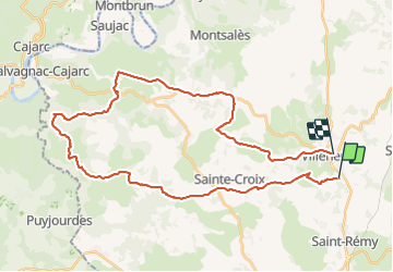
Villeneuve LeBournac Les Farguettes Lantouy RteCajarc Tourrens Ols Bervuc Tastayre Villeneuve

Gerard_Soulie
User

Length
40 km

Max alt
429 m

Uphill gradient
695 m
Km-Effort
50 km

Min alt
158 m

Downhill gradient
659 m
Boucle
No
Creation date :
2023-10-15 07:38:59.389
Updated on :
2023-10-15 10:35:53.498
2h39
Difficulty : Medium

FREE GPS app for hiking
 SityTrail
IGN / Geographical institutes
SityTrail Plus
The world is yours!
About
Trail Mountain bike of 40 km to be discovered at Occitania, Aveyron, Villeneuve. This trail is proposed by Gerard_Soulie.
Positioning
Country:
France
Region :
Occitania
Department/Province :
Aveyron
Municipality :
Villeneuve
Location:
Unknown
Start:(Dec)
Start:(UTM)
423263 ; 4919702 (31T) N.
Comments