


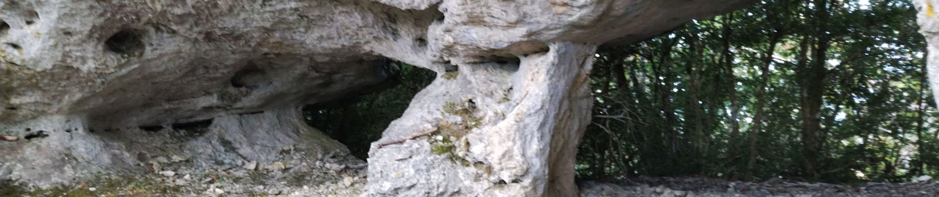
Arches de Combleroufle

cousam
User
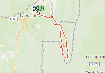

Length
7.3 km

Max alt
1222 m

Uphill gradient
356 m
Km-Effort
12 km

Min alt
938 m

Downhill gradient
344 m
Boucle
Yes
Creation date :
2023-10-15 07:28:18.29
Updated on :
2023-10-15 10:55:36.241
3h26
Difficulty : Medium

FREE GPS app for hiking
 SityTrail
IGN / Geographical institutes
SityTrail Plus
The world is yours!
About
Trail Walking of 7.3 km to be discovered at Auvergne-Rhône-Alpes, Drôme, Le Chaffal. This trail is proposed by cousam.
Photos


Positioning
Country:
France
Region :
Auvergne-Rhône-Alpes
Department/Province :
Drôme
Municipality :
Le Chaffal
Location:
Unknown
Start:(Dec)
Start:(UTM)
672642 ; 4972742 (31T) N.
Comments