


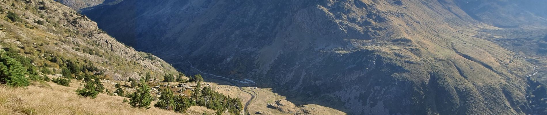
pic de caballiere

chrisgps
User
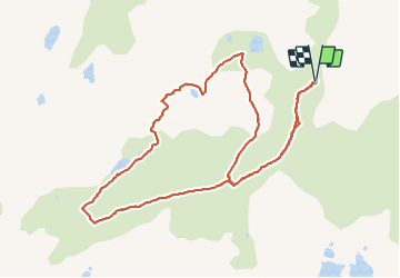

Length
12 km

Max alt
2530 m

Uphill gradient
861 m
Km-Effort
23 km

Min alt
1692 m

Downhill gradient
861 m
Boucle
Yes
Creation date :
2023-10-12 07:12:10.111
Updated on :
2023-10-16 17:25:09.316
5h20
Difficulty : Medium

FREE GPS app for hiking
 SityTrail
IGN / Geographical institutes
SityTrail Plus
The world is yours!
About
Trail Walking of 12 km to be discovered at Occitania, Ariège, Aston. This trail is proposed by chrisgps.
Description
en boucle par les étangsde Caballière et de Mirabail
Photos


Positioning
Country:
France
Region :
Occitania
Department/Province :
Ariège
Municipality :
Aston
Location:
Unknown
Start:(Dec)
Start:(UTM)
393721 ; 4722739 (31T) N.
Comments