


Lac Bleu, Lac Ourec

chasle
User
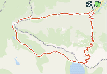

Length
14.8 km

Max alt
2243 m

Uphill gradient
1190 m
Km-Effort
31 km

Min alt
1066 m

Downhill gradient
1187 m
Boucle
Yes
Creation date :
2023-10-16 14:56:33.15
Updated on :
2023-10-16 14:57:19.216
6h58
Difficulty : Difficult

FREE GPS app for hiking
 SityTrail
IGN / Geographical institutes
SityTrail Plus
The world is yours!
About
Trail Walking of 14.8 km to be discovered at Occitania, Hautespyrenees, Bagnères-de-Bigorre. This trail is proposed by chasle.
Positioning
Country:
France
Region :
Occitania
Department/Province :
Hautespyrenees
Municipality :
Bagnères-de-Bigorre
Location:
Unknown
Start:(Dec)
Start:(UTM)
262630 ; 4760738 (31T) N.
Comments