Trail Walking Lantosque - cime de Suorcas en boucle  - Photo
 nadd73
nadd73

User

© OpenStreetMap contributors
Length
Length
14.5 km
Max alt
Max alt
1502 m
Uphill gradient
Uphill gradient
814 m
Km-Effort
Km-Effort  
25 km
Min alt
Min alt
802 m
Downhill gradient
Downhill gradient
813 m
Boucle
Boucle
Yes
Creation date :
2023-10-15 08:07:41.865
Updated on :
2023-10-16 17:58:51.956

(0 Reviews)

Walking
Walking
4h04
Difficulty : Very difficult

Scan this QR Code to open this trail in the SityTrail application

FREE GPS app for hiking

Logo SityTrail SityTrail

IGN / Geographical institutes

Download SityTrail from the App Store Download SityTrail from Google Play

Logo SityTrail SityTrail World

The world is yours!

Download SityTrail from the App Store Download SityTrail from Google Play Download SityTrail on Huawei AppGallery

About

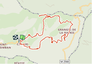
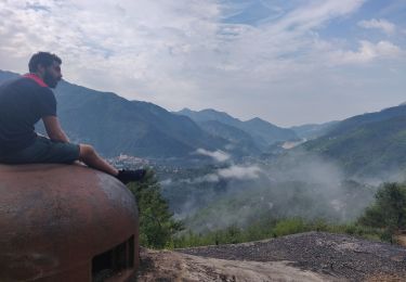
Trail Walking of 14.5 km to be discovered at Provence-Alpes-Côte d'Azur, Maritime Alps, Lantosque. This trail is proposed by nadd73.

Description

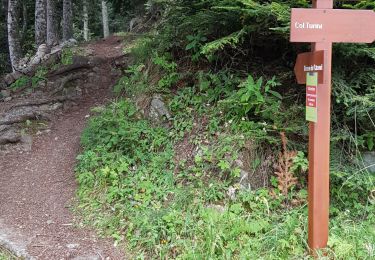
Départ de Camari. La montée est très pénible, le sentier est parfois inexistant ou disparaît donc ronces, genets, aubépines .. sont présents. Ce sont les animaux sauvages qui font qu'une vague trace existe.

Elevation profile

Photos

Positioning

Country:
France
Region :
Provence-Alpes-Côte d'Azur
Department/Province :
Maritime Alps
Municipality :
Lantosque
Location:
Unknown
Start:(UTM)
366474 ; 4868229 (32T) N.

Trails nearby

Trail On foot Moulinet - Crêtes de l'Arpiha - Photo
On foot
PRO

On foot

Easy
Moulinet, Provence-Alpes-Côte d'Azur, Maritime Alps, France
6.5 km | 10.5 km-effort
2h 22min
Yes
Trail On foot Moulinet - Tour de la Calmette - Photo
On foot
PRO

On foot

Easy
Moulinet, Provence-Alpes-Côte d'Azur, Maritime Alps, France
7.1 km | 11.2 km-effort
2h 32min
Yes
Trail Walking Moulinet - Turini- tour de la Calmette - Photo
Walking
patsure

Walking

Easy
Moulinet, Provence-Alpes-Côte d'Azur, Maritime Alps, France
7.8 km | 12.6 km-effort
2h 6min
Yes
Trail Walking Lantosque - lant - Photo
Walking
jlgott

Walking

Difficult
Lantosque, Provence-Alpes-Côte d'Azur, Maritime Alps, France
10.7 km | 21 km-effort
2h 59min
No
Trail Walking Lucéram - Beasse Peira Cava  - Photo
Walking
Renefrt

Walking

Difficult
Lucéram, Provence-Alpes-Côte d'Azur, Maritime Alps, France
19 km | 31 km-effort
9h 50min
Yes
Trail Snowshoes La Bollène-Vésubie - Col de Turini a la pointe des 3 communes - Photo
Snowshoes
GrouGary

Snowshoes

Medium
La Bollène-Vésubie, Provence-Alpes-Côte d'Azur, Maritime Alps, France
11.1 km | 17.4 km-effort
6h 4min
Yes
Trail Walking Lantosque - hameau de beasse  - Photo
Walking
Mariephil

Walking

Difficult
Lantosque, Provence-Alpes-Côte d'Azur, Maritime Alps, France
10.9 km | 16.2 km-effort
5h 13min
Yes
Trail Nordic walking La Bollène-Vésubie - Etape 4 - Photo
Nordic walking
blaise70

Nordic walking

Very easy
La Bollène-Vésubie, Provence-Alpes-Côte d'Azur, Maritime Alps, France
18.2 km | 30 km-effort
7h 53min
No
Trail Walking Lantosque - lanbolan - Photo
Walking
jlgott

Walking

Medium
Lantosque, Provence-Alpes-Côte d'Azur, Maritime Alps, France
11.2 km | 22 km-effort
2h 57min
Yes


Close
My subscriptions