


SityTrail - Sortie du 08/06/2017

les randos d'Olivier
partout a pied et en moto

Length
16.1 km

Max alt
127 m

Uphill gradient
287 m
Km-Effort
19.9 km

Min alt
38 m

Downhill gradient
283 m
Boucle
Yes
Creation date :
2023-10-17 09:34:05.843
Updated on :
2023-10-17 09:58:31.283
4h31
Difficulty : Very difficult

FREE GPS app for hiking
 SityTrail
IGN / Geographical institutes
SityTrail Plus
The world is yours!
About
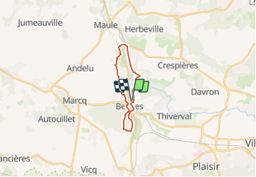
Trail Walking of 16.1 km to be discovered at Ile-de-France, Yvelines, Beynes. This trail is proposed by les randos d'Olivier.
Description
La vallée de la Mauldre : Beynes / Montainville / Mareil sur Mauldre / La Maladrerie
Points of interest


Positioning
Country:
France
Region :
Ile-de-France
Department/Province :
Yvelines
Municipality :
Beynes
Location:
Unknown
Start:(Dec)
Start:(UTM)
417561 ; 5412339 (31U) N.
Comments