


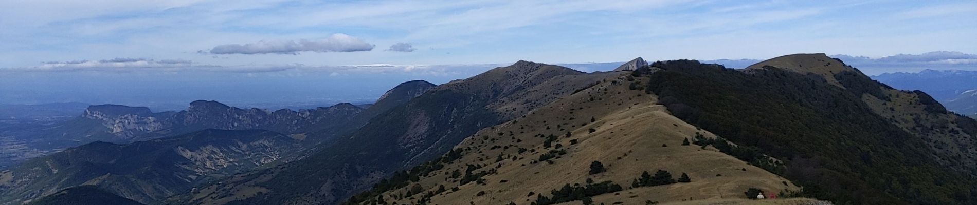
Serre Délégué depuis Rochefourchat 15 10 23

bymarc26
User
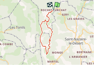

Length
14.3 km

Max alt
1469 m

Uphill gradient
810 m
Km-Effort
25 km

Min alt
840 m

Downhill gradient
810 m
Boucle
Yes
Creation date :
2023-10-15 07:29:51.996
Updated on :
2023-10-17 09:35:58.992
4h29
Difficulty : Medium

FREE GPS app for hiking
 SityTrail
IGN / Geographical institutes
SityTrail Plus
The world is yours!
About
Trail Walking of 14.3 km to be discovered at Auvergne-Rhône-Alpes, Drôme, Rochefourchat. This trail is proposed by bymarc26.
Description
à faire dans le sens que j'ai pratiqué
Belle rando. En mai juin avec les genêts en fleur ce doit être magnifique
Photos


Positioning
Country:
France
Region :
Auvergne-Rhône-Alpes
Department/Province :
Drôme
Municipality :
Rochefourchat
Location:
Unknown
Start:(Dec)
Start:(UTM)
678319 ; 4940759 (31T) N.
Comments