


greasque. helene

NADINE52
User
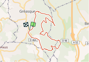

Length
10.7 km

Max alt
398 m

Uphill gradient
198 m
Km-Effort
13.4 km

Min alt
291 m

Downhill gradient
197 m
Boucle
Yes
Creation date :
2023-10-17 08:33:44.124
Updated on :
2023-10-17 13:21:25.406
3h09
Difficulty : Difficult

FREE GPS app for hiking
 SityTrail
IGN / Geographical institutes
SityTrail Plus
The world is yours!
About
Trail Walking of 10.7 km to be discovered at Provence-Alpes-Côte d'Azur, Bouches-du-Rhône, Gréasque. This trail is proposed by NADINE52.
Positioning
Country:
France
Region :
Provence-Alpes-Côte d'Azur
Department/Province :
Bouches-du-Rhône
Municipality :
Gréasque
Location:
Unknown
Start:(Dec)
Start:(UTM)
706019 ; 4810905 (31T) N.
Comments