


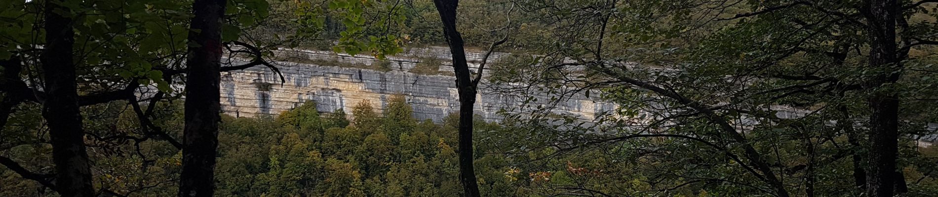
Cascades du Hérisson

David25400
User GUIDE
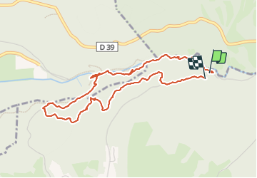

Length
4.8 km

Max alt
775 m

Uphill gradient
214 m
Km-Effort
7.6 km

Min alt
588 m

Downhill gradient
197 m
Boucle
Yes
Creation date :
2023-10-15 12:37:18.204
Updated on :
2023-10-21 09:53:42.717
1h56
Difficulty : Very easy

FREE GPS app for hiking
 SityTrail
IGN / Geographical institutes
SityTrail Plus
The world is yours!
About
Trail Walking of 4.8 km to be discovered at Bourgogne-Franche-Comté, Jura, Bonlieu. This trail is proposed by David25400.
Photos


Positioning
Country:
France
Region :
Bourgogne-Franche-Comté
Department/Province :
Jura
Municipality :
Bonlieu
Location:
Unknown
Start:(Dec)
Start:(UTM)
719624 ; 5166262 (31T) N.
Comments