


roc des chevres

bidetarou
User

Length
10.1 km

Max alt
120 m

Uphill gradient
195 m
Km-Effort
12.7 km

Min alt
26 m

Downhill gradient
195 m
Boucle
Yes
Creation date :
2023-10-22 07:18:14.117
Updated on :
2023-10-22 08:49:13.967
1h30
Difficulty : Difficult
1h30
Difficulty : Medium

FREE GPS app for hiking
 SityTrail
IGN / Geographical institutes
SityTrail Plus
The world is yours!
About
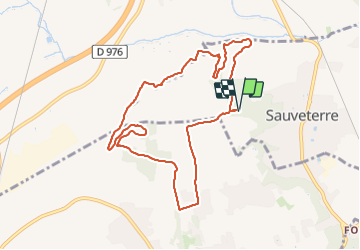
Trail Running of 10.1 km to be discovered at Occitania, Gard, Sauveterre. This trail is proposed by bidetarou.
Description
Promenade ou trail partie difficile au niveau de la piste de DH
Positioning
Country:
France
Region :
Occitania
Department/Province :
Gard
Municipality :
Sauveterre
Location:
Unknown
Start:(Dec)
Start:(UTM)
642868 ; 4876202 (31T) N.
Comments